 Skip to main content

New York Highway Regeneration Aims to Addresses Inequality Across the State
)
Roads in New York have cost a lot.
Outside of the expenses to build the web of thoroughfares and highways post-World War II, many of these roadways have torn the fabric out of many Black, Hispanic and immigrant communities — razing churches, paving over green spaces, and buttressing segregation.
| A look back at the construction of Rochester's Inner Loop and what's ahead. Jamie Germano, Rochester Democrat and Chronicle |
Meanwhile, those projects often made it easier for whiter suburbanites to traverse between cities and their homes, researchers have said.
Hoping to redress the destruction, New York is looking to move ahead with several transportation projects in Rochester, Buffalo, Syracuse, and the Bronx. In some cases, the work will involve reconnecting neighborhoods by removing stretches of highway or creating park space over expressways.
"New York must use its infrastructure opportunities of today to revitalize communities torn apart by infrastructure decisions of the past," Gov. Kathy Hochul said while proposing several such projects in her State of the State address last month.
Funding for the work will include $20 billion set aside in President Joe Biden's infrastructure plan to "reconnect neighborhoods cut off by historic investments." The state's five-year $32.8 billion Department of Transportation plan would use the federal funding commitments for several of the projects.
But there's still likely work to be done, even with funding set aside.
Peter Muennig, professor of health policy and management at Columbia University's Mailman School of Public Health, said many urban highways were built through diverse communities and that the phenomenon is likely more widespread than the localities laid out in the governor's State of the State address.
"There are lots of examples of communities being torn apart by these freeway projects," said Muennig. "Basically, anywhere that's urban, that has a major freeway or expressway going through it, was probably ... impacted in that way."
The Congress of New Urbanism, a proponent of walkable urbanism, has noted several highway projects across the country that could be rethought, including the Claiborne Expressway in New Orleans and Interstate 5 in Seattle.
Here are four across New York:
The Bronx
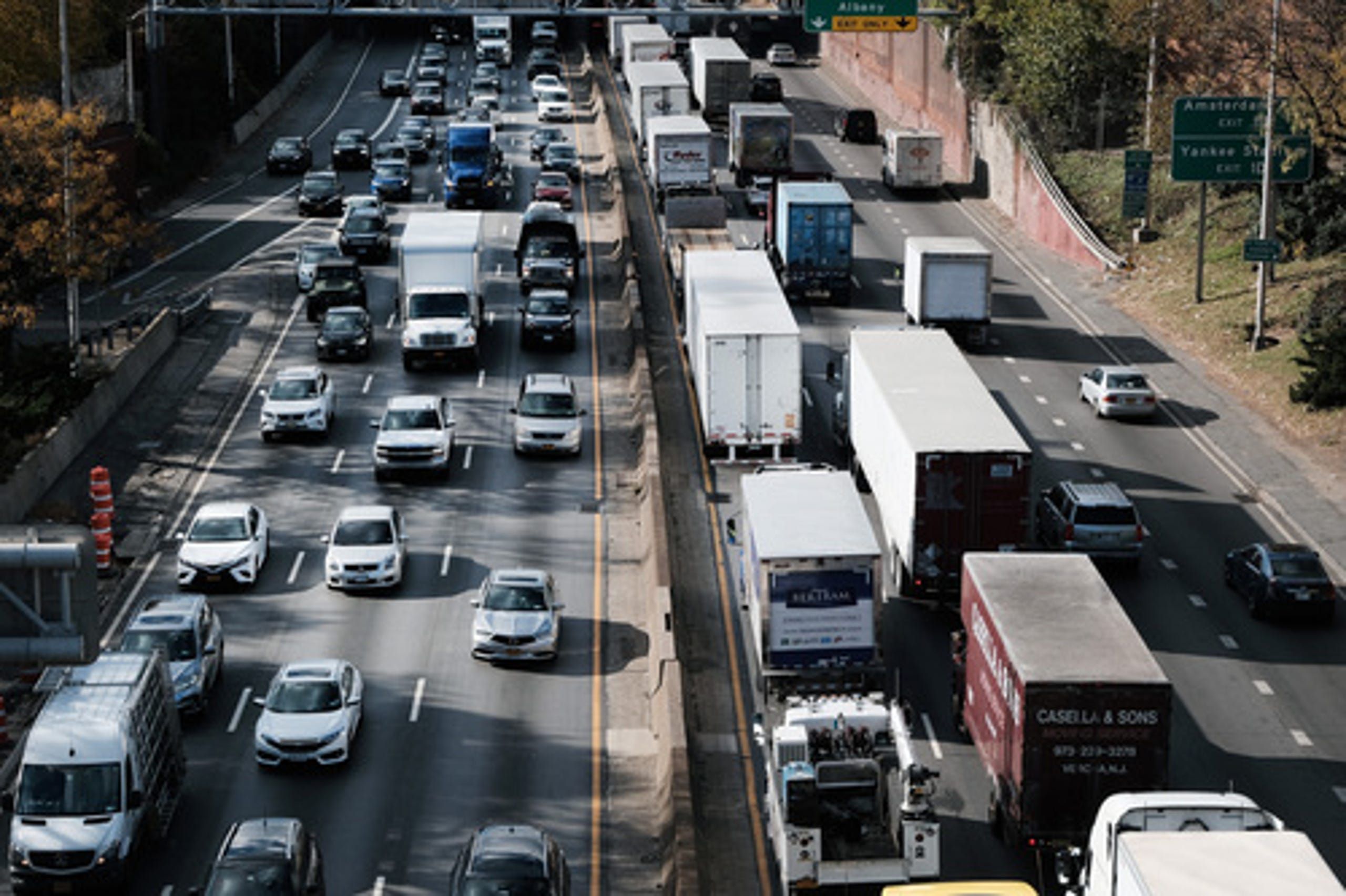 |
| Cars and trucks move along the Cross Bronx Expressway, a notorious stretch of highway in New York City that is often choked with traffic and contributes to pollution and poor air quality on November 16, 2021 in New York City. |
Community members in the Bronx found fertile ground for a park atop the Cross-Bronx Expressway.
Residents and officials are hoping to place public amenities over the six-lane highway that cuts through the South Bronx as a means of opening public spaces and enhancing pedestrian safety.
They hope the creation of the park could also help remediate air quality and other issues brought on by the expressway, which carries 175,000 trucks a day through an area heavily populated by Black and Hispanic people.
Built between 1948 and 1972, the 6.5-mile expressway has been linked with health problems, Muennig, who has published research on transforming the expressway to reduce air pollution and create green space.
Muennig said residents living around the roadway often deal with elevated levels of noise and air pollution. He also noted that it is sometimes difficult for community members to visit family members living on the other side of the expressway because of the physical barrier.
He believes that work on the expressway will open a host of new possibilities for its surrounding communities, including a potential community recreation and more affordable housing.
Although there was a lesser-populated alternative route, the construction of the roadway displaced thousands of New Yorkers. Those who stayed, researchers say, saw the demolition of housing, loss of green space, and even, voting power.
Landlords in the communities would later burn down some of those buildings for insurance payouts, researchers say.
Today is not the same Bronx of yore. But the neighborhoods divided by the highway have some of the highest asthma rates in the country, as well as the worst air pollution and highest rates of diabetes in New York City.
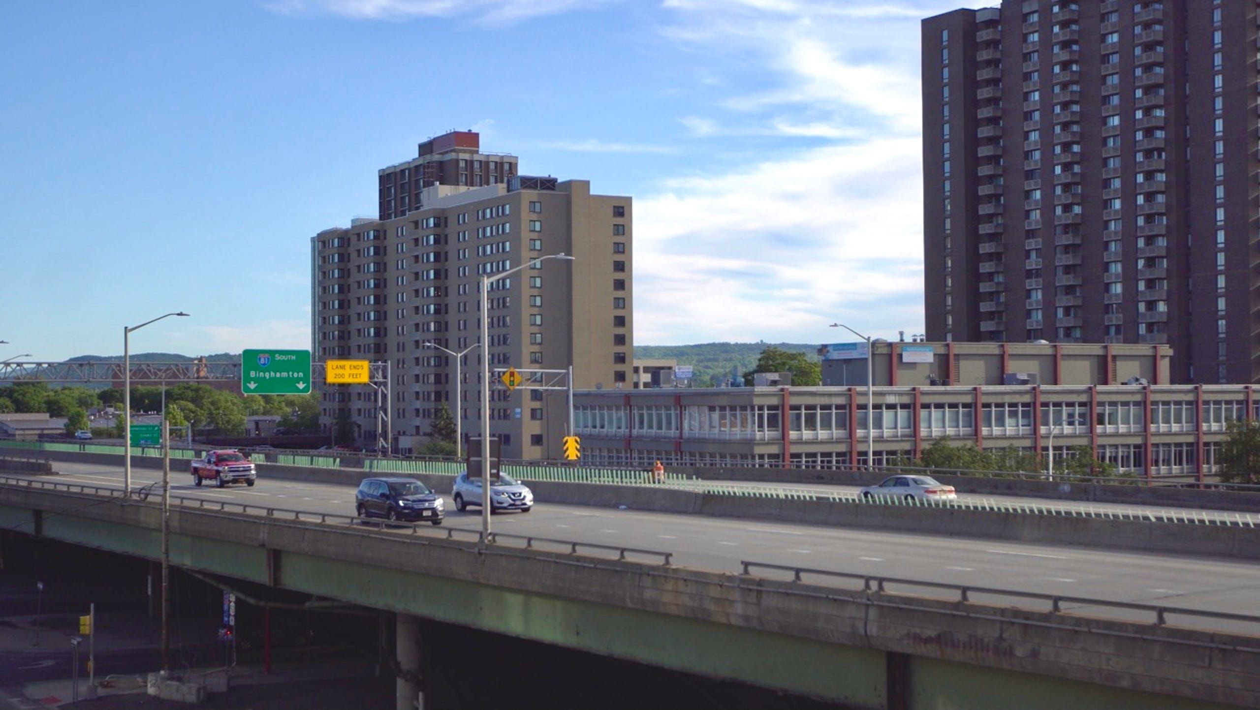
Rochester
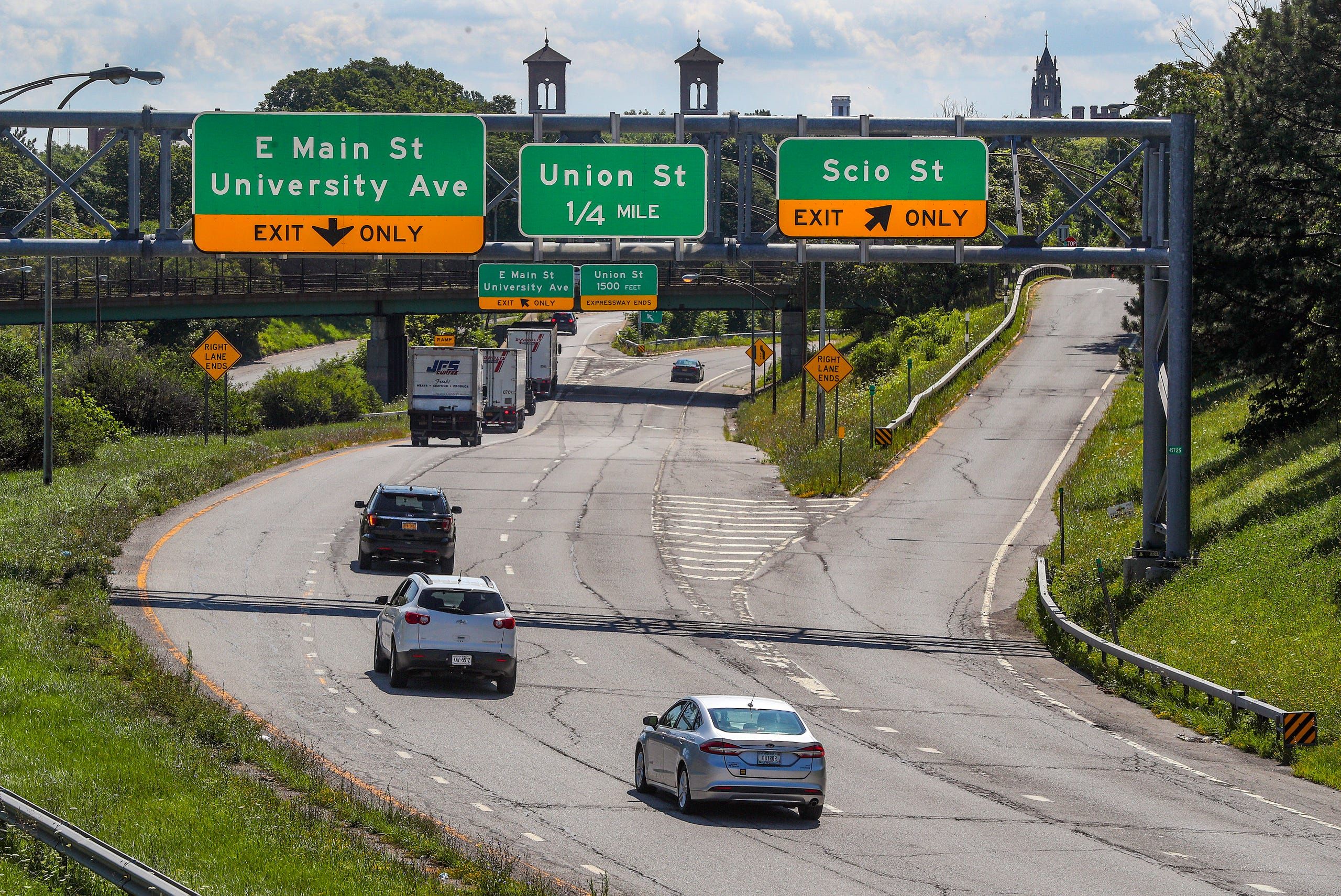 |
| A view of the Inner Loop where major construction will have an impact on that neighborhood. |
Decades after the construction of the Inner Loop, the city of Rochester is continuing its work to unpave the freeway’s destructive legacy.
In 2017, Rochester raised and connected a stretch of the Inner Loop to at-grade city streets, while converting eight to 12 lanes of expressway and frontage roads into one two-lane, low-speed street, the state said.
That project also eliminated three bridges and retaining walls, while freeing up six acres of land for new development, government officials said. It also removed a physical barrier to downtown Rochester.
Now, the Inner Loop North razing project is proposed to "fully reconnect severed communities within downtown Rochester," according to Hochul's State of the State.
The project hopes to provide direct links to the Genesee River and the High Falls District and create new green spaces, officials said. The state Transportation Department will partner with the city to conduct an environmental review of the designs.
The urban highway, completed in states between 1952 and 1965, was heralded at the time as a congestion reliever, particularly for people coming from the suburbs, according to the Rochester Democrat and Chronicle.
But parts of the roadway, notably the last arc of the Loop to be constructed, proved the most destructive, the newspaper reported. The arc also reinforced segregation already done through redlining, thereby creating an additional barrier for residents of a Black and immigrant neighborhood.
Buffalo
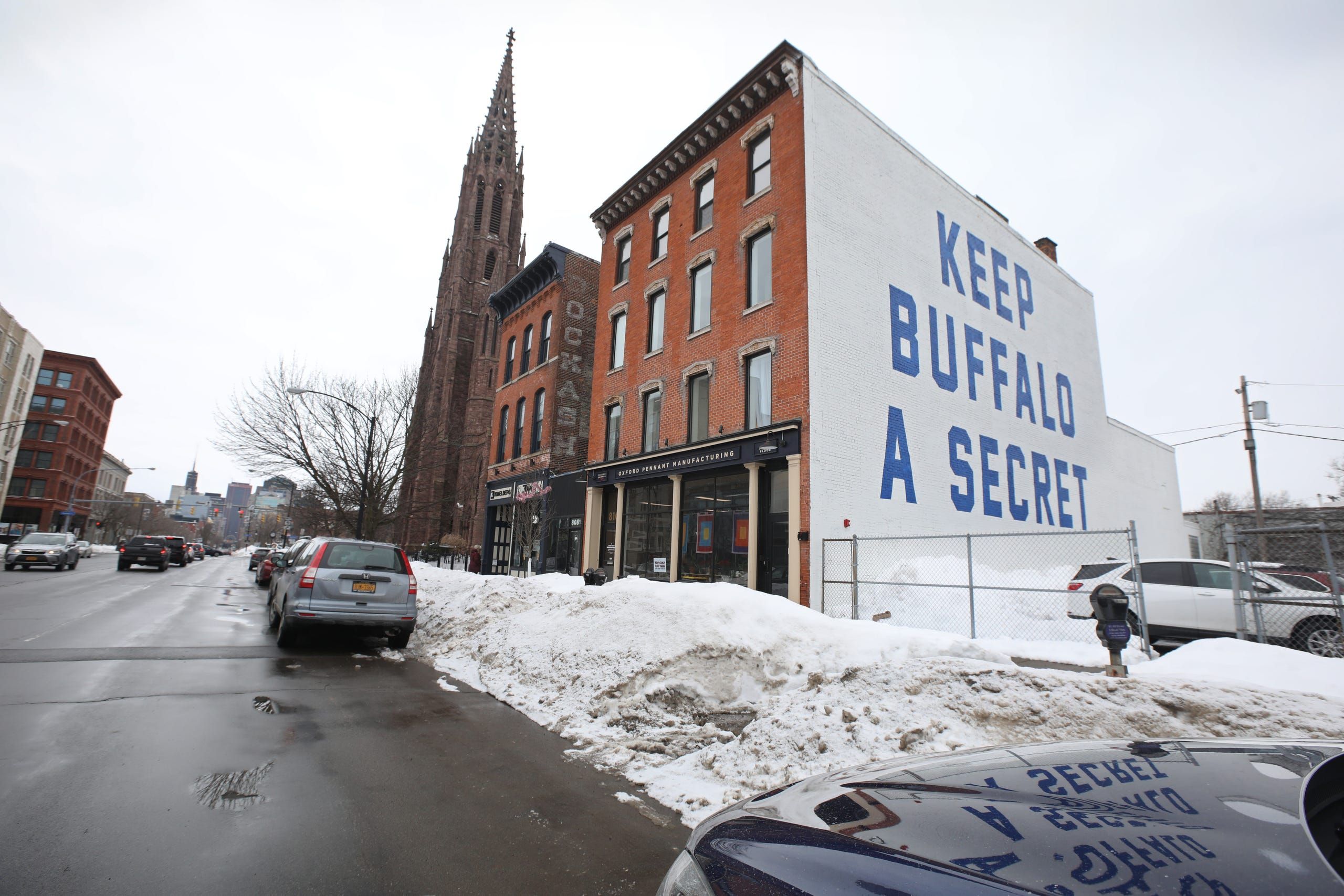 |
| What started as a bumper sticker, "Keep Buffalo A Secret" is now a giant mural on the side of Oxford Pennant Manufacturing's building in the heart of downtown Buffalo, NY. |
Before the construction of the Kensington Expressway, the park-like neighborhood of Humbold Parkway was home to a tree-lined boulevard, state officials said.
But the construction of the expressway changed the neighborhood’s character and brought a flow of cars and pollution, residents have said.
Today, the pollution coming from vehicles is blamed for some chronic health conditions such as asthma, according to WBFO in Buffalo.
The effort to help remediate those changes includes reconnecting the east-west neighborhoods "across depressed sections of the Kensington Express corridor," as well as re-establishing green space in the community.
Syracuse
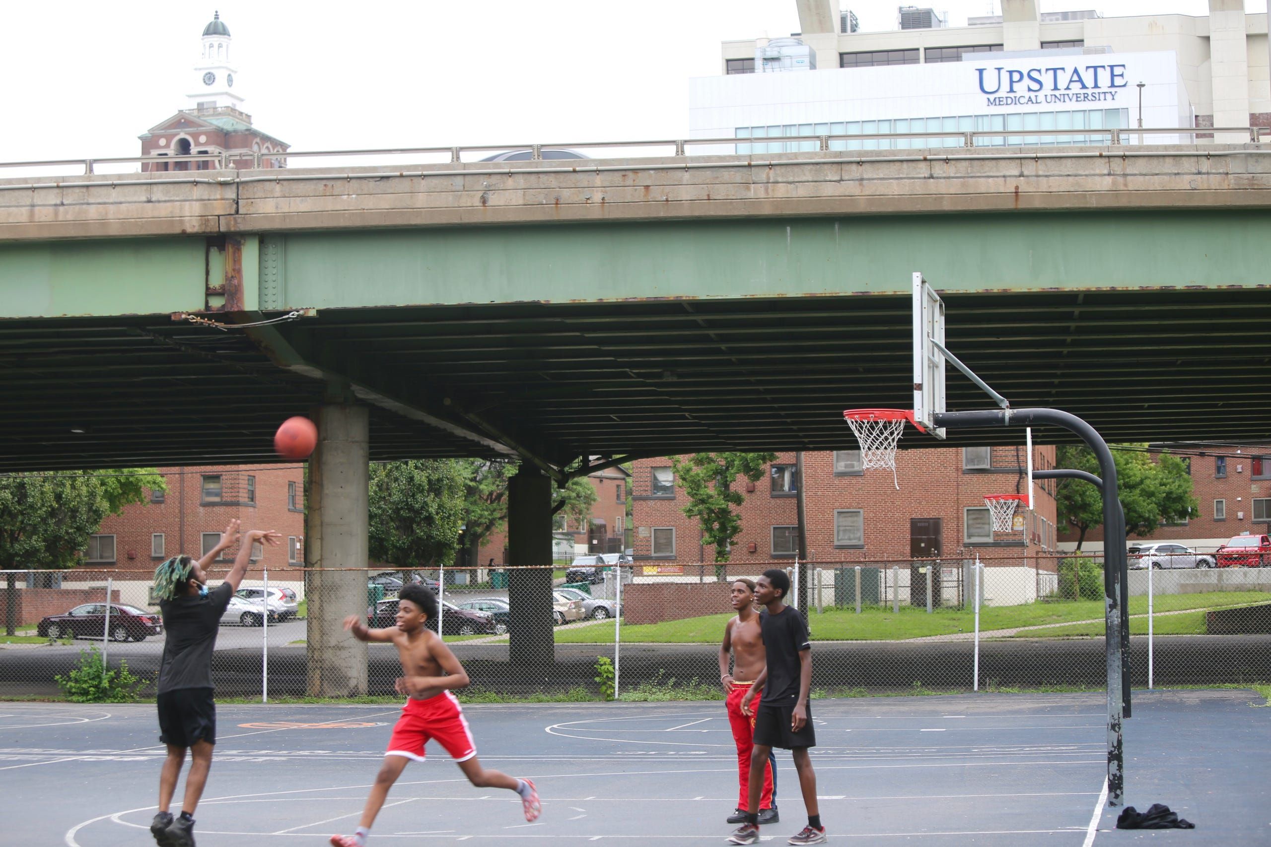 |
| Syracuse, NY. Young men play basketball with I-81 and Upstate medical towering over their game in the background. |
When construction finished, Syracuse’s Interstate 81 served as an essential travel corridor, moving drivers through the downtown area and the Central New York region, researchers said.
For the city's 15th ward, it would mean the end of life as it had been. The roadway decimated the Black and Jewish community, weaving land of traffic through it, according to "'White Men’s Roads Through Black Men’s Homes'*: Advancing Racial Equity Through Highway Reconstruction."
Black residents who were displaced moved to other neighborhoods in the city, the paper said. Their white counterparts moved to the suburbs.
The stretch continues to serve as a “line of demarcation” — Syracuse University, some SUNY ESF, and several hospitals on one side, low-income neighborhoods on the other, the researchers noted.
Today, state and local officials are working to reconnect neighborhoods by replacing the viaduct with a community grid that would “disperse traffic along north-south streets,” officials said.
 |
| The 1.4 mile stretch of I-81 that slices through Syracuse separating its opportunity from its poorest neighborhoods. |
That move would create opportunities for mixed-use residential and commercial development. The project would also create pedestrian and bike access with the downtown area.
Building on the I-81 project, there are plans to "reimagine" the East Adams neighborhood, where more than 1,000 public housing units are located.
The revitalization effort would create a mixed-use, mixed-income neighborhood.
Source: PressConnects
New York Build is the leading construction, design and real estate show for New York and the Tri-State Area.
Register for your free tickets now to gain access to 300+ top industry speakers across 11 tracks and AIA CES approved workshops, 250+ exhibitors, exclusive free-to-attend networking events including the Women in Construction and Diversity in Construction, exciting entertainment, New York's Festival of Construction, celebrity guests and much more!
REGISTER FOR TICKETS
)